

In a new study published in the June 2021 issue of Earth Science Reviews, an explanation of the mystery of ancient fossils discovered in the Antilles Islands in Central America, which contained fossils of ancient wildlife that had originated in South America.
The study attributed the reason to areas of land that were transport bridges between the Americas, but it sank long ago in the depths of the ocean due to several factors, the most important of which may be the movement of tectonic plates and the melting of glaciers throughout the ages.
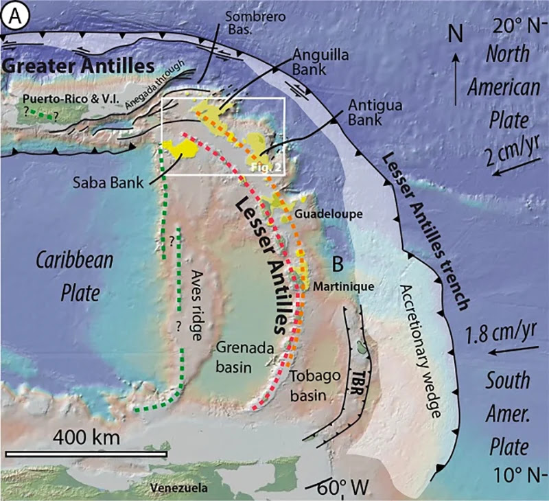
Tectonic plate movement simulation
Researchers from French, British and Romanian universities modeled some 40 million years of tectonic plate movement around the junction between the Lesser Antilles, the Greater Antilles, and the Aves Ridge underwater mountain, demonstrating how landmasses could be formed and broken down again.
The emergence and disappearance of these archipelagos and “mega-islands” would also have been affected by the rise and fall of the sea level, controlled by glacial melt – something else the scientists modeled across a period of 1.5 million years.
The seismic data observed in the region over the past 40 million years were studied, in addition to evaluating the current geography of the islands.
The team was able to work backwards to the late Eocene period, matching island shorelines with the era when they would have emerged from the ocean.
The beginning of the Eocene period was marked by the emergence of modern mammals and ended with a massive mass extinction believed to have resulted from a giant meteor collision with Earth in the Siberian region at the time.
|
| The study area is shown in the white rectangle. (Cornée et al., Earth-Science Reviews, 2021) |
Future studies targeting the Caribbean plate
The Antilles constitute the archipelago located between the Caribbean Sea, the Atlantic Ocean and the Gulf of Mexico is divided into two main groups, namely, the Greater Antilles, which lies to the north and includes Cuba, Jamaica, Hispaniola and Puerto Rico, and the Lesser Antilles, which includes the Leeward Islands, the Windward Islands and the Venezuelan coastal islands.
These land bridges are more common than you might think, existing for millions of years and then disappearing for millions more. There was once a connection between Russia and Canada, for instance, and between the UK and the rest of Europe.
Given the scarcity of studies that have been concerned with the Antilles region, this study is considered the first of its kind to present a simulation model concerned with this amount of detail and factors that can affect the entire region. Using this developed model, the researchers hope to extend their study southward to cover the entire Caribbean slab.
With these results, researchers continue to search for a more complete fossil record for the Lesser Antilles, in addition to the need to better visualize the geography of the ancient region between Guadeloupe and Venezuela in order to more accurately determine the previously existing land movement paths.
The researchers concluded that “The role of the Lesser Antilles in the dispersal of land fauna during the last 40 million years must therefore be reassessed.”
Sources:
- https://www.sciencedirect.com/science/article/abs/pii/S3